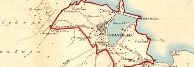
In January 1832, Holyhead’s Clerk of the Peace was obliged to draw up a Parish Valuation in order to record the dwellings in the town. This document still exists and it gives us a fascinating snapshot of the town just after the completion of Telford’s ‘Great Holyhead Road’. We learn that the population of the parish at that time was 4,282 and the total number of recorded dwellings was 349.* The town had 34 streets with Stanley Crescent and Market Street being the longest (42 and 40 dwellings respectively) and Hill Street with 3 dwellings, Turkey, with 3 dwellings and Parliament Ditch with its 2 dwellings being the shortest. Some streets remain to this day but others have long disappeared. Who now remembers Willow Garden Row, Well Row and Ponctybobtu?
Market Street and Stanley Crescent were not only the longest streets but also the busiest. There was a Saddler, a Hatter, a Druggist, an Eating house and 3 Public Houses in Market Street (Rose & Crown, Red Lion, King’s Head), whilst Stanley Crescent housed a Sailroom, a Shipwright Yard, a Druggist and 2 Public Houses (The Legs of Man and the Spirit Vaults). Other trades in the town included a Smithy and a Joiner in New Street, two Coal Merchants in Church Lane and a Brew House in Ponctybobtu.
Some dwellings were not in streets – Ucheldre Park, the Tan Yard, the Royal Hotel, the Hibernian Inn and the New Brewery are listed as individual buildings.
Of course, the maritime connection was strong with many houses being identified by the names of sea captains who lived there, e.g. Captain Evan Lloyd’s House in Church Lane; Captain Goddard, Captain Skinner, Captain Grey and Captain Evans’ Houses in Stryd. Captain Duncan’s House and Captain Owens’ House were recorded as individual houses.
Other dwellings bore the name of the occupation of the owner or tenant, e.g. a Guard’s House in Market Street was probably the home of the Mail Coach Guard and the Waiter’s House in the same street probably referred to the house of a Tide Waiter (a Customs official). Dr Walthew also had a house in Market Street.
When the Electoral Roll was published later in 1832, it showed that of the 862 men aged 20 years or older who lived in Holyhead, only 70 were eligible to vote in general elections. In those unenlightened times women were denied the vote which meant that only about 3% of the total adult population could help choose a Member of Parliament. This small band of voters included Sir John Thomas Stanley of Penrhos, Dr Walthew, Robert Spencer (landlord of the Royal Hotel), Edmund Roberts of Ucheldre Park, Owen Owens (the solicitor), the Rev. William Morgan (Minister of Bethel Chapel) and Thomas Powell of Llys-y-Gwynt.
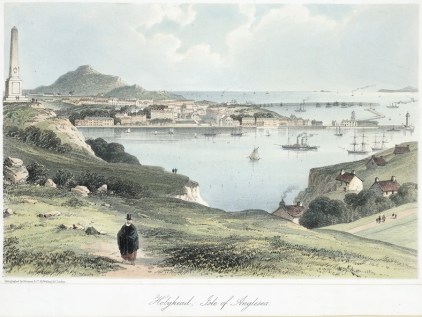
Within 12-15 years of this Parish Valuation, Holyhead would experience tremendous and far-reaching changes as the railway age dawned, and so this particular ‘snapshot’ of 1832 could well represent an end of an era. The Holyhead of 1852 would prove to be a very different place.
*The Valuation was carried out in order to calculate who would be eligible to vote after the passing of the Reform Act of 1832. It is highly likely that the poorest dwellings were not listed as the people living there were unlikely to be included in the Electoral Roll.
Contributed by Dr. Gareth Huws
**Image of Holyhead map from https://www.antiquemapsandprints.com/
